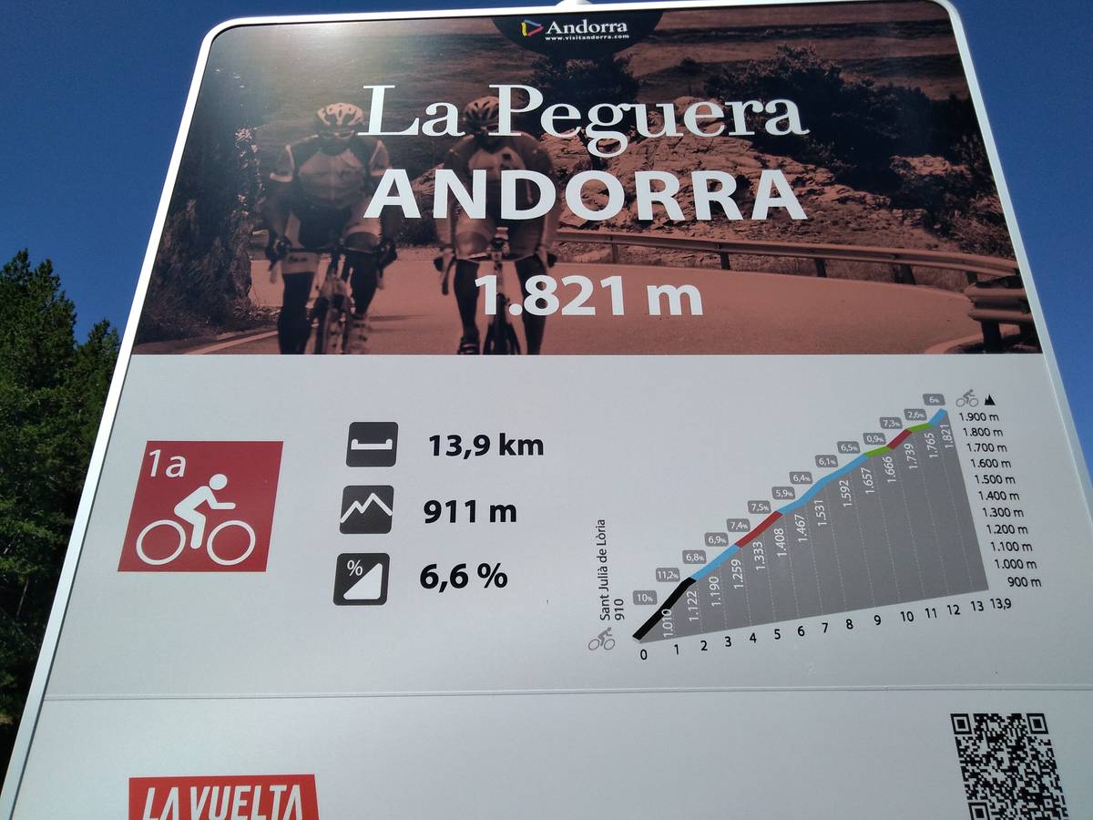
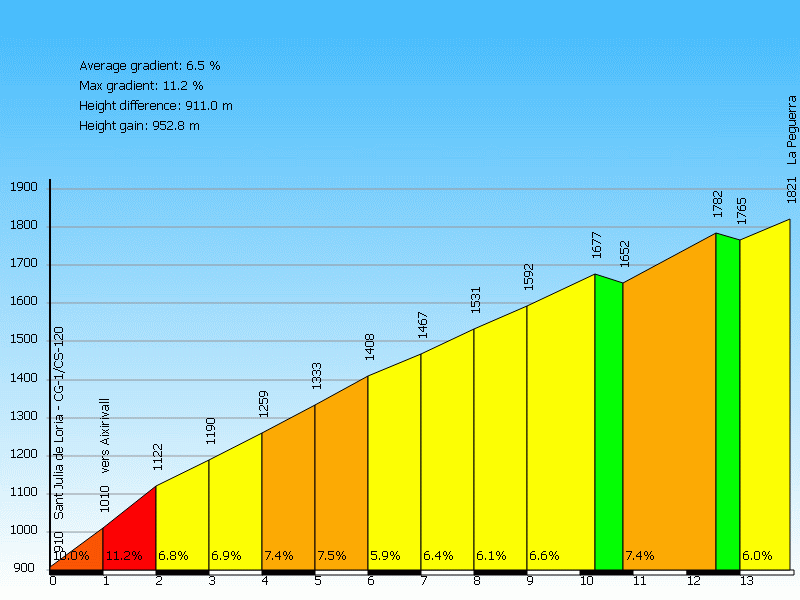
Information
| Name : | La Peguera |
| Altitude : | 1821 m |
| Start : | Sant Julia de Loria (via Aixirivall) |
| Length : | 13.94 km |
| Elevation gain : | 911 m |
| % Avg : | 6.54% |
| % Max : | 14.0% |
| Mountain range : | Central pyrenees, Andorra |
There's other climb of this summit
Map
Profile
 Ascents reserved for cyclists